GPR complements traditional Electromagnetic (EM) Technology by:
Delineating utilities in close proximity
Providing reliable depth estimates
Allowing for data visualization to better map the subsurface
Reporting and archiving results for future reference
Integrating data with third-party software (eg. Google Earth)
Our Service
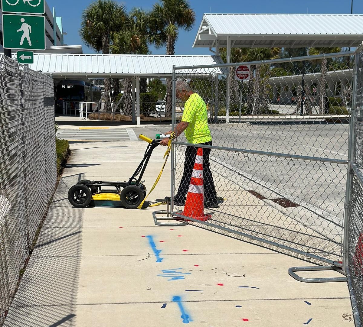
Using Ground Penetraring Radar (GPR)
Gather depth information of buried infrastructure
Utilities close to each other
Verify locates with GPR
Grid Scan
Visualize Complex sites
Map abandoned utilities
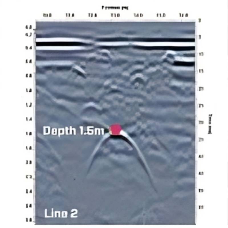
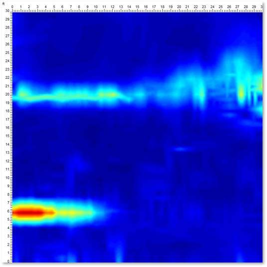
This example shows the location of a concrete storm sewer. GPR was able to find this “non-locatable” and determine the depth of the utility and that it was on a slope, aiding with horizontal direction drilling planning.
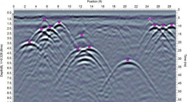
GPR can map all utilities in a single survey. With the availability of in-field interpretations and viewing options, the multiple utility lines can be mapped easily on-site.
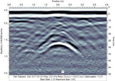
GPR is often used to verify locates performed using other technologies. Many companies hire GPR service providers for peace of mind that their site is fully cleared and accurately marked prior to beginning excavation.
Using a grid scan of a complex area, you can visualize linear utilities at varying depths. This helps to provide an understanding of the subsurface while still on site.
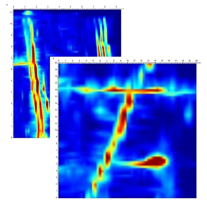
Using a grid scan of a complex area, you can visualize linear utilities at varying depths. Even closely spaced utilities can be detected as individual lines. This example shows eight buried pipes in a relatively small area.
GPR can map abandoned, non-locatable utilities that may not be detected with traditional methods. In this example, the utility shown on the bottom was capped and could not be located using traditional pipe and cable locators. A grid scan was collected over the area; the depth slices identifying the abandoned, capped utility.
We are your best option
We has experienced professionals that will help by locating your unidentified underground utilities.